Mid/Late Week Hazardous Weather Update – April 10
Published 8:57 am Monday, April 10, 2023
|
Getting your Trinity Audio player ready...
|
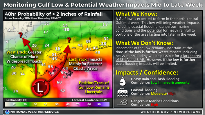
Overview:
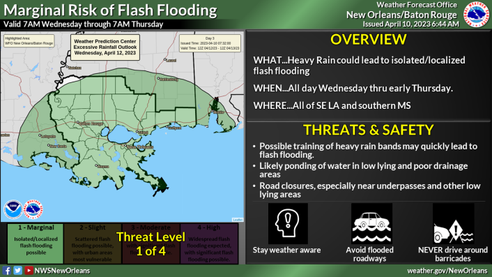
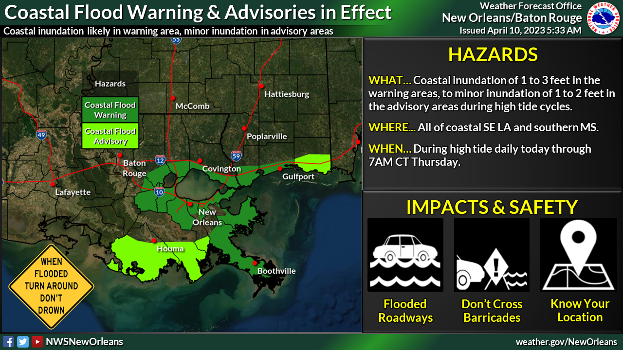
WHAT: Coastal Flood Advisory/Warning & MARGINAL RISK of Heavy Rain
WHEN: Minor coastal flooding beginning as early as high tide cycle this afternoon, increasing for each high tide cycle thru Thursday. All day Wednesday into early Thursday for risk of excessive rainfall.
WHERE: All coastal areas for the coastal flood advisories/warnings, All of SE LA and southern MS for the Marginal Risk of excessive rainfall.
CONFIDENCE: Low in regards to heavy rain/flash flooding [area/amounts]. Moderate/High in regards to coastal flooding and high for dangerous marine conditions.
Impacts:
- Coastal Flooding:
- Inundation of 1 to 3 feet possible during peak high tide cycle in the areas under a Coastal Flood Warning.
- Minor inundation of 1 to 2 feet possible during peak high tide cycle in the areas under a Coastal Flood Advisory.
- Coastal locations in Jackson County may be upgraded to a warning in subsequent updates as impacts may occur beyond 36 hours at peak high tide Thursday and Friday.
- Heavy Rainfall/Flash Flooding:
- Confidence in the potential for flooding impacts remains low, and highly dependent on the low track. A track further west may introduce a more widespread risk of heavy flash flooding from slow-moving bands of heavy rainfall.
- A track further east would reduce potential flooding impacts for most of the area.
- Marine Impacts
- Gusty winds and elevated waves/seas are likely, with Small Craft Advisories in effect. Gale conditions would be possible near and to the east / northeast of the eventual low track.