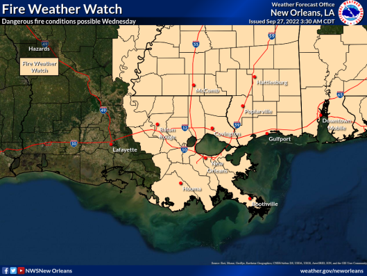
Hurricane Ian Update – September 27; local area under fire weather watch for Wed
Published 9:44 am Tuesday, September 27, 2022
|
Getting your Trinity Audio player ready...
|
Changes from previous update:
No significant changes to the forecast track and intensity from the previous update.
A Red Flag Warning has been posted through 7pm today.
Overview:
- Hurricane Ian is a major hurricane and will enter the southeastern Gulf of Mexico later this morning
- It is currently forecast to make landfall along the western Florida Peninsula later this week.
- Red Flag Warning for dry, windy conditions making fires easier to ignite, maintain and spread rapidly
- Fire Weather Watch Wednesday for the possibility of continuing conditions supporting fire spread

Confidence: There is normal confidence in the forecast regarding Ian. Moderate confidence in fire weather issues
Impacts:
- It remains unlikely that Ian will bring any significant impacts to southeast Louisiana or southern Mississippi. Remember that impacts can occur outside the forecast cone, especially for large storms.
- While not directly due to Ian, breezy conditions are currently expected Tuesday through Friday. The current forecast calls for sustained winds near 20 mph with gust potential in excess of 30 mph mainly near and along the coast. These winds could blow around lightweight and loose outdoor objects and make driving difficult. A wind advisory may be issued.
- For those with marine interests, large swells and gusty winds are expected to affect the Gulf waters starting tonight through Friday. These winds and swells will result in hazardous conditions across the coastal waters, especially beyond 20 nautical miles from shore.
- Fire weather conditions will promote rapid fire spread with plenty of dry fuels and strong winds.


