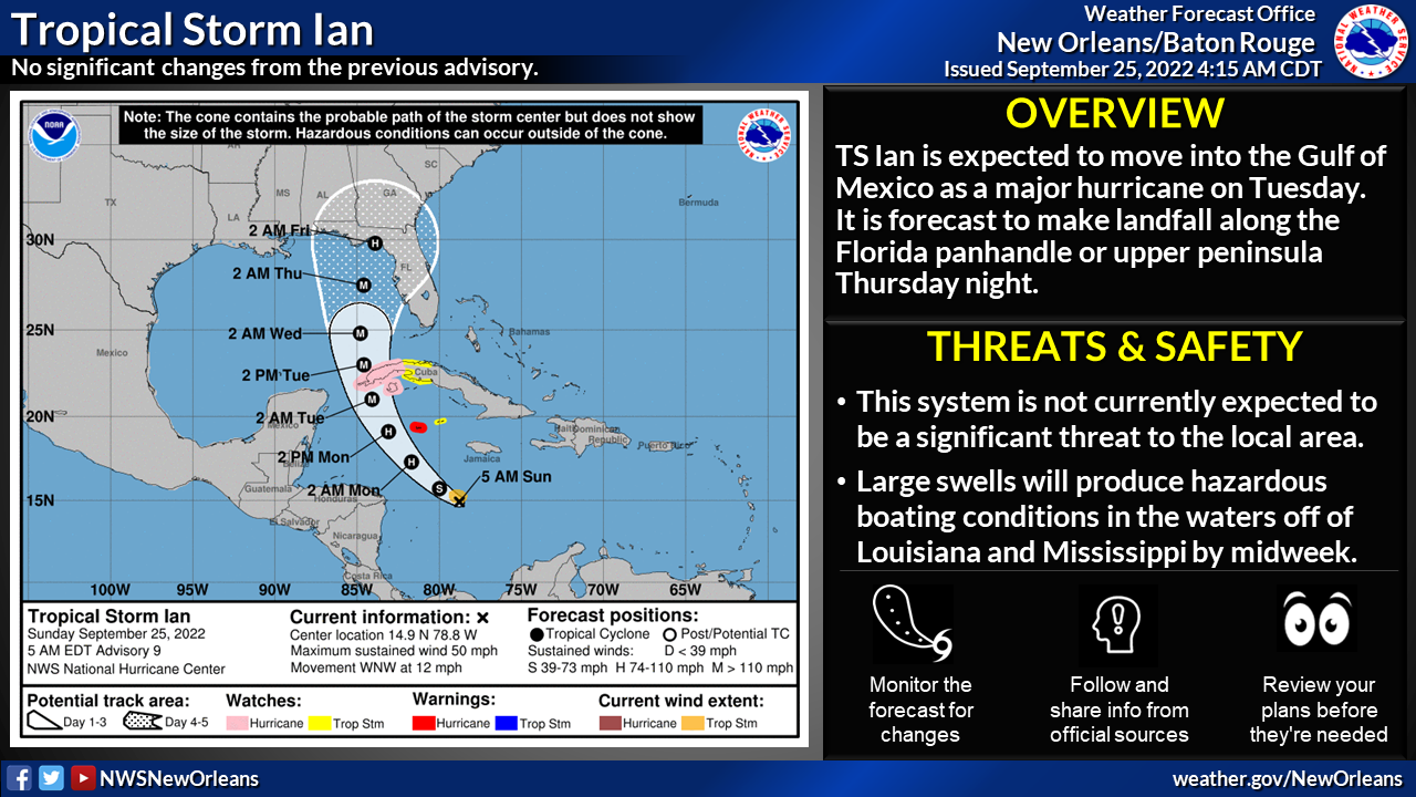
Tropical Storm Ian Update – September 25
Published 10:18 am Sunday, September 25, 2022
|
Getting your Trinity Audio player ready...
|
Changes from previous update:
- A slight shift west in the forecast track.
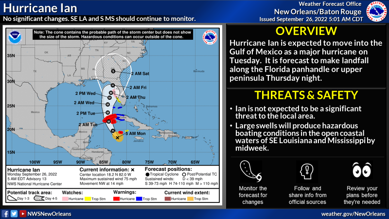
Overview:
- Tropical Storm Ian is expected to strengthen into a major hurricane before entering the southeastern Gulf of Mexico on Tuesday
- It is currently forecast to make landfall along the Florida panhandle or upper Florida peninsula Thursday night
Confidence: There is normal confidence in the short-term forecast regarding TS Ian. There continues to be lower than normal confidence in the forecast beyond Monday and additional shifts in the forecast track are possible.
Impacts:
- This system is not currently expected to bring any significant impacts to southeast Louisiana or southern Mississippi. However, because Ian is expected to be a large storm, any further shifts to the west could begin to result in some minor local impacts, especially across coastal Mississippi and portions of extreme southeast Louisiana. Remember that impacts can occur outside the forecast cone, especially for large storms.
- For those with marine interests, large swells and gusty winds are expected to affect the Gulf waters by the middle of next week and will result in hazardous conditions across the coastal waters, especially beyond 20 nautical miles from shore during the Wednesday through Friday timeframe.
- Some waves/swells could reach the open shoreline, resulting in a rip current threat along Grand Isle and Ship Island.