Severe Weather and Heavy Rain Update – Thursday March 16
Published 8:13 am Thursday, March 16, 2023
|
Getting your Trinity Audio player ready...
|
Changes from the previous update:
-
The timing has slowed a tad with rain likely holding off until close to sunrise.
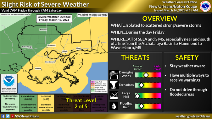
Overview:
WHAT: MARGINAL RISK to SLIGHT RISK of Severe Weather and MARGINAL RISK of Excessive Rain
WHEN: Friday
WHERE: All of SELA and S MS
CONFIDENCE:
-
We are confident there will be thunderstorms associated with the cold front tomorrow across the area. We have some confidence that a few storms will be strong to severe and if timing slows down anymore the risk for severe storms may increase due to more higher instability.
-
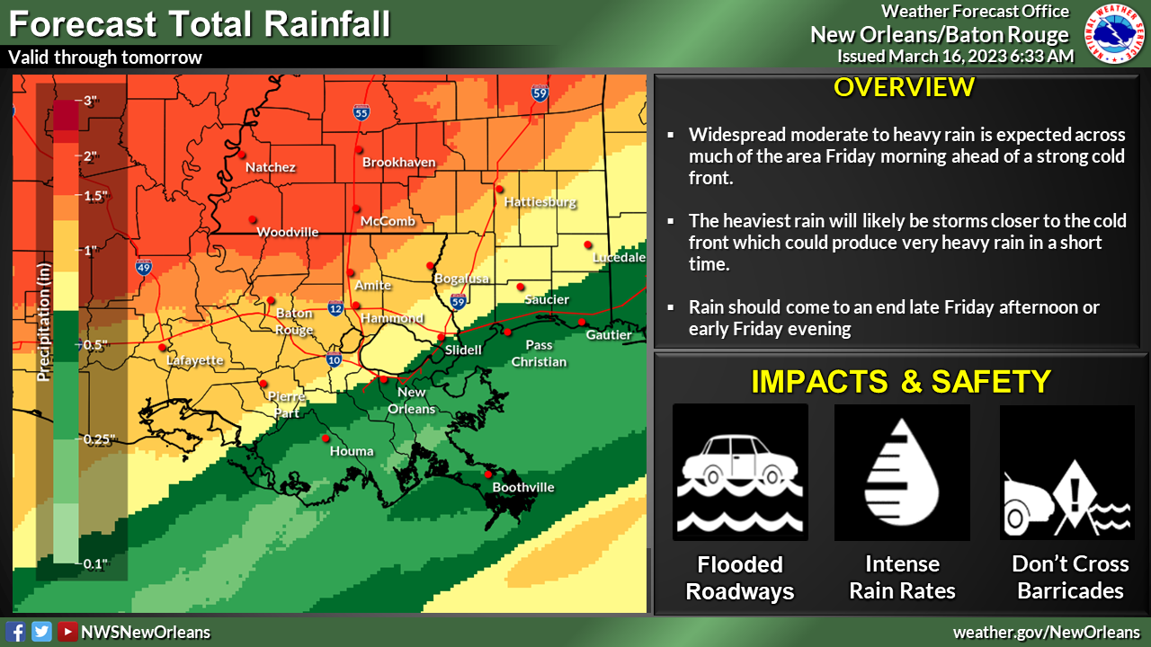
We are confident that any thunderstorm that develops will be capable of producing locally heavy rain but flash flooding is low due to the overall progressive motion of the cold front. (Slower timing doesn’t necessarily mean a slow-moving cold front, just that its arrival would be a little later. Once the cold front moves into the area it will continue to push southeast)
The main threats associated with any severe storms will be:
Damaging Winds:
-
Wind gusts greater than 60 mph will be possible with the strongest storms
-
Trees and powerlines could be damaged and lead to isolated/scattered power outages
Tornadoes:
-
A few tornadoes will be possible but this threat is very low with damaging wind gusts the primary concern.
Rainfall
- In addition to the severe weather threat, rainfall of 1 to 2.5 inches is forecast with locally higher amounts possible.