Marginal risk of excessive rainfall Tuesday
Published 9:17 am Tuesday, July 12, 2022
|
Getting your Trinity Audio player ready...
|
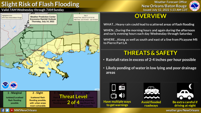
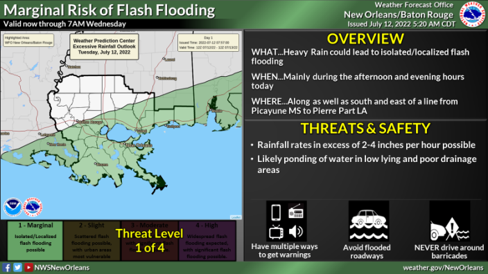
WHAT: MARGINAL RISK of Excessive Rainfall Today
SLIGHT RISK of Excessive Rainfall Wednesday through Saturday
WHEN: Most days will have the highest rainfall potential during the daylight hours each day through Saturday.
WHERE: All of SE LA and S MS, with the greatest threat in areas south of the I-10/12 corridor.
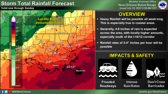
CONFIDENCE: We have above average confidence in the heavy rain threat through at least mid week with typical uncertainty pertaining to who will get exactly how much rainfall. Increasing concern for flash flooding starting Wednesday along as well as south and east of a line from Pierre Part LA to Poplarville MS.
Threats/Impacts:
For the heavy rainfall potential:
- Rainfall rates in excess of 2-4 inches per hour are possible
- High rainfall rates can quickly lead to ponding of water in low lying and poor drainage areas
- Flash flooding will be possible in some places, especially urban areas, where high rainfall rates exceed drainage capacity