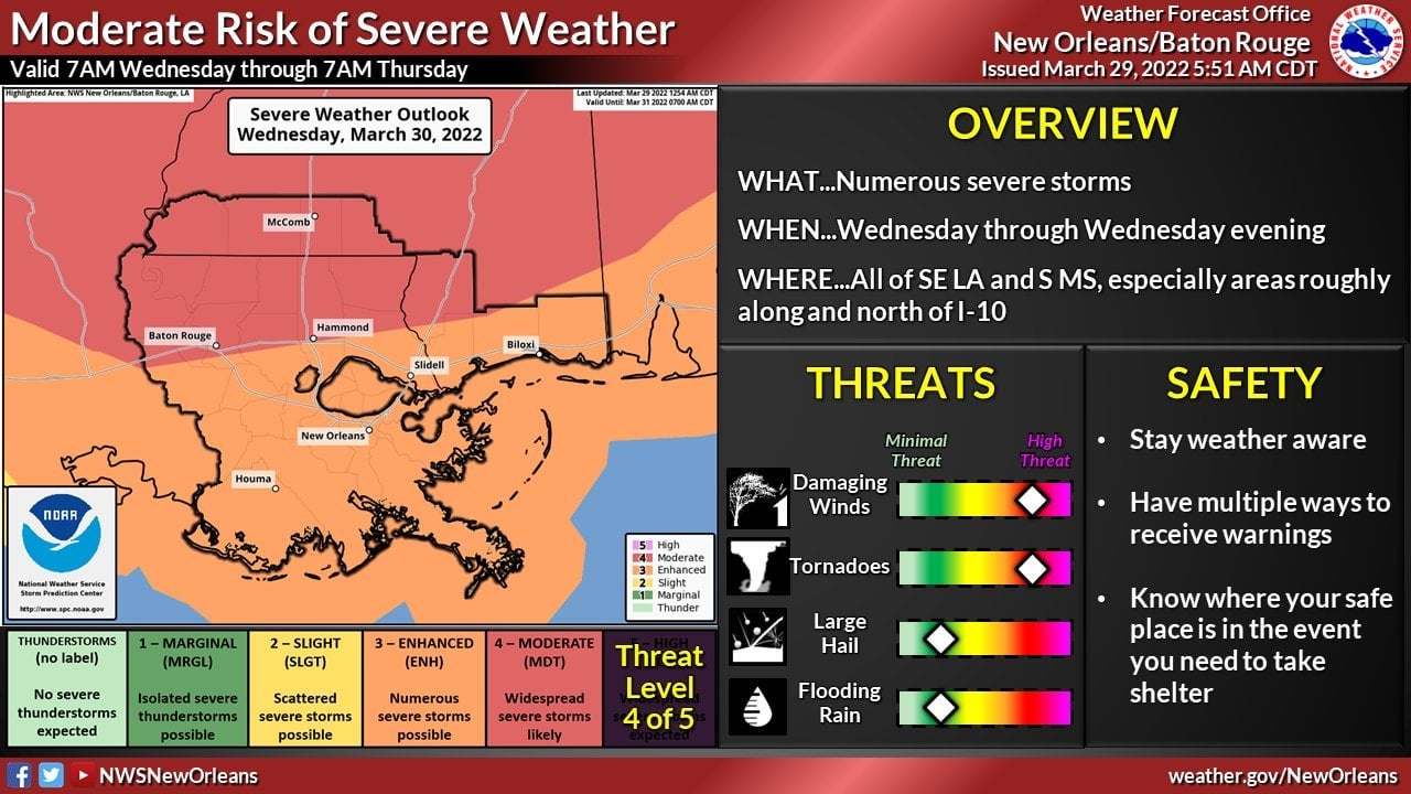
Weather threat for Wednesday increases to ENHANCED risk
Published 12:21 pm Tuesday, March 29, 2022
|
Getting your Trinity Audio player ready...
|
The risk for severe weather for tomorrow has INCREASED to an ENHANCED risk with the biggest threats being wind speeds capable of toppling trees (in excess of 50 mph).
There is a risk for strong damaging winds of 70+ mph, tornadoes and hail as well. Stronger than normal winds are likely, which could cause power outages before and after storms.
The River Parishes will likely see the biggest impacts between 4 p.m. to 8 p.m. tomorrow evening.
Residents should take time today to secure any loose items around their homes as it is likely that a wind advisory will go into effect tomorrow morning at 8 a.m. Now is the time to make sure catch basins and storm drains are clear.
Every system is different, so residents should stay weather aware and have multiple ways to receive alerts.
You can sign for SCPAlerts by visiting www.scpemergencyalerts.com or by texting SCPALERTS to 888777.
St. John Parish residents can sign up for alerts by texting SJPWEATHER to 888-777.