High school students work toward GIS certification
Published 12:00 am Saturday, June 26, 2021
|
Getting your Trinity Audio player ready...
|
LAPLACE — Students in the St. John the Baptist Parish Jump Start Summers 2021 program are working toward a GIS industry-based certification exam that can put them on a pathway to a variety of geospatial technology careers.
The one-year certificate in GIS will allow students to work as GIS assistants or GIS technicians. Further experience will allow students to follow the GIS career pipeline toward occupations including but not limited to criminal justice, disaster management, emergency response, engineering, hazard and risk analysis, oil and gas pipelines, real estate, marine and coastal ecology, utilities, and travel and tourism.
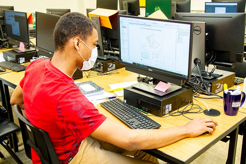
Rising sophomores, juniors and seniors have engaged in classroom learning at East St. John High School from 8 a.m. to 4 p.m. Monday through Thursday since June 1. The course will continue through July 8, at which time the students will transition straight into taking the certification exam.
Shannon Smith-Magee said Jump Start Summers is a robust, state-wide program that has helped high school students earn credentials for the past four years. This is the third year the program has been in St. John Parish, and every year brings something different. The first year saw students become proficient in Adobe Photoshop. This year, the GIS program is teaching students to capture, store, analyze and display spatial or geographical data.
Global Geospatial Institute founder Fran Harvey said students are getting hands-on experience and career training through this program.
“We really like the model for several reasons. It’s intensive, but they are in a lab environment, which is what’s best for GIS. They end up offering peer support to each other, which is really valuable and what we like to see,” Harvey said.
Students have learned to use GIS for flood modeling, urban development, planning, search and rescue, and more. They’ve conducted site suitability analyses, which help professionals determine where to locate the next hospital or grocery store. Another project prompted students to utilize demographics data through the U.S. Census to map the male/female population age 25 or older that have earned college degrees.
Harvey said community partners are crucial to the success of the program. Rebecca Hymel, GIS administrator/IT coordinator for St. John Parish, welcomed students to the Parish Government Building on June 25 for half a day of job shadowing.
“Ms. Hymel is very open-minded and welcoming of students. She wants to show the students how government uses GIS across many offices, including the clerk of court, planning and zoning and emergency operations,” Harvey said.
According to Harvey, a St. John STEM Magnet Program student who completed the GIS course on her own time last semester is now interning with Planning and Zoning.
Stanley Bienemy, director of economic development for St. John Parish, also served as a guest speaker for the Jump Start Summers Program.
Harvey added that the parental involvement that Smith-Magee has incorporated as part of Jump Start Summer 2021 has been a positive influence toward the overall success of the program. Smith-Magee set high expectations for the program that included a pre-requisite GPA of 3.0 or higher. Students must arrive to the computer lab on time, or they risk being kicked out of the program.
“These students want to be here. They are serious about it, and it shows,” Harvey said.
Student Justin Duhe said he took part in the program because it seemed fun, and he wanted to learn something new. He’s enjoyed working with maps based around storms and hurricane season, as well as making legends to help others understand how to read the maps.
According to Justin, the Jump Start Summers Program helps students broaden their horizons by giving them ideas for future career options.
Student Malaja Williams applied for the program after hearing about the career possibilities surrounding GIS.
“I’m going to be honest; the monetary value had something to do with it, but as the course went on, I wasn’t even thinking about that,” Malaja said. “I was just thinking about completing it and what I can do with these skills in the future, honing the abilities I’ve learned and trying to keep it in my mind.”
Malaja added that it was interesting to look at the topography of land surfaces through satellite imaging. She’s also learned to get information through data mining.
While she has a lot of ideas for her future, she could see herself exploring geocoding further.