Giant map brings giant smiles
Published 12:00 am Tuesday, January 24, 2012
By ROBIN SHANNON
L’Observateur
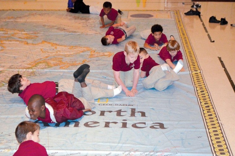
LAPLACE – With the help of one of the world’s largest maps of North America, students at John L. Ory Magnet School and Emily C. Watkins Elementary School in LaPlace will spend the week exploring the intricacies that make up the continent, as well as the bodies of water surrounding it.
Teachers across every grade level are using interactive classroom exercises to encourage students to dive into geography through exploration of the map, which is on loan from the National Geographic Society. The 35-foot by 26-foot floor map, which takes up the entire auditorium at John L. Ory, will be on display at the school until Feb. 3 as part of the Giant Traveling Maps Program.
“It is a once-in-a-lifetime kind of event and we are happy to have a chance to utilize it,” said John L. Ory Principal Terri Noel. “It is a fun way to get our students excited about learning geography.”
The map includes a trunk of accessories and lessons geared toward specific age groups. Students at Ory will explore the map through Friday, when students from Emily C. Watkins visit the school to take part in the program.
According to National Geographic’s website, the Giant Traveling Maps program was introduced in 2006 with a map of Africa, and has since expanded to maps of North America, Asia, South America, and the Pacific Ocean. In the 2011-2012 school year it is estimated that more than 450,000 students will interact with at least one of the maps.